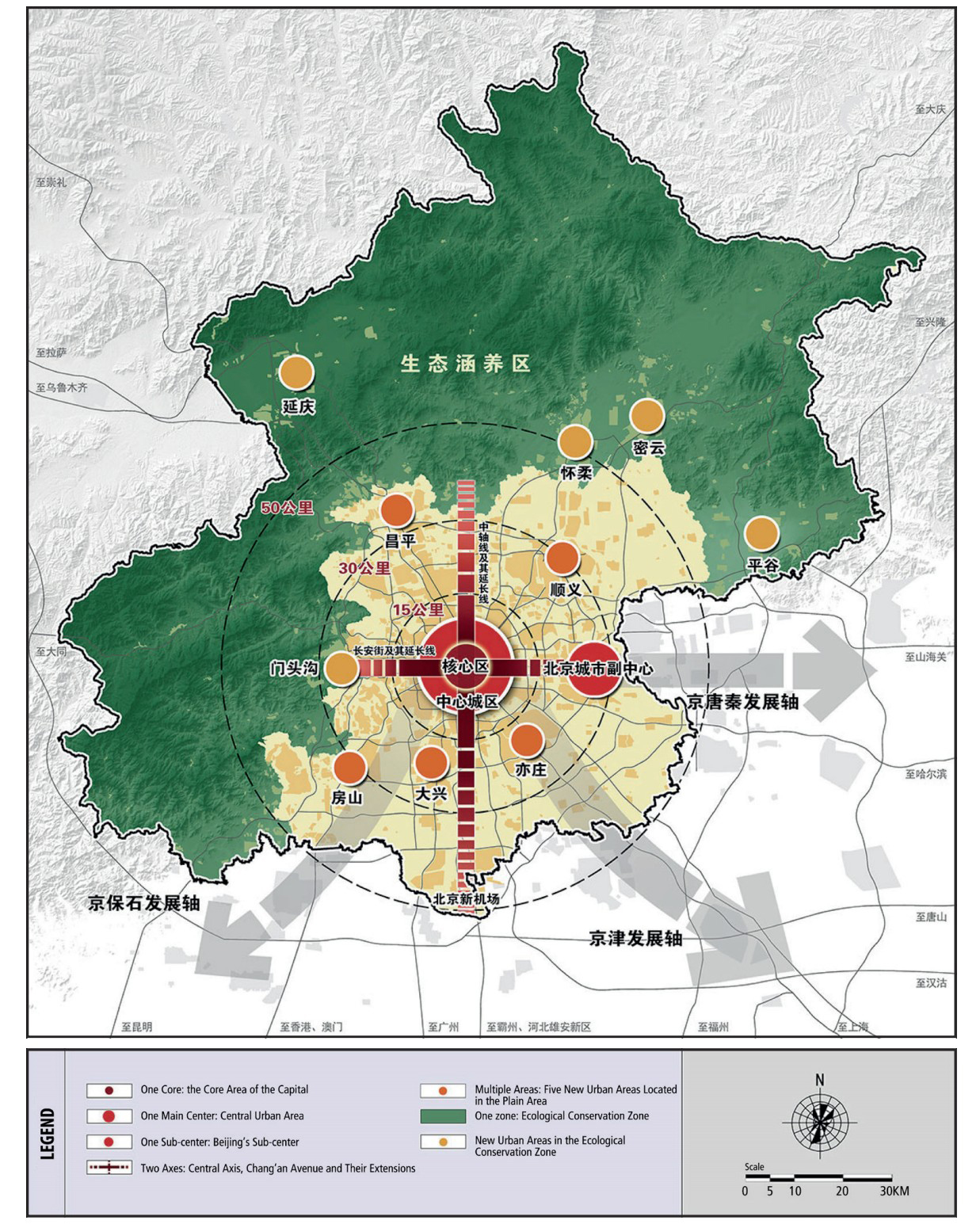
The nominated property and buffer zone of Beijing Central Axis involve the core area of the capital (Dongcheng and Xicheng districts), the Chaoyang district, and the Fengtai district. The current planning system of the urban environment of Beijing Central Axis consists of plans of various levels including the Beijing Master Plan (2016-2035), the Regulatory Plan for the Core Area of the Capital (2018-2035), the Conservation Plan for the Historical and Cultural City of Beijing (2002), and the Conservation and Management Plan for Beijing Central Axis (2022-2035).
Beijing Master Plan (2016-2035)
Link
Beijing’s urban master plan is updated about every decade. The previous editions of the master plan all emphasized the need to protect and continue the “traditional urban central axis” (the Beijing Central Axis) planning pattern. The Beijing Master Plan (2016-2035) is authorized by the Central Government, issued by the People’s Government of Beijing Municipality, and enjoys the highest level of authority. The Beijing Master Plan (2016-2035) positions Beijing as the national political center, cultural center, international communication center, and technological innovation center. Beijing requires better conservation of the historical and cultural heritage and the establishment of the historical and cultural city conservation system covering the old city, the central urban area, the municipal administrative area of Beijing, and the region of Beijing, Tianjin, and Hebei province. The plan stresses the significance of the “traditional central axis” in shaping the historical layout of the ancient capital. It points out that the future development of the traditional central axis and its extensions shall focus more on the cultural function. It requires the enhancement of the spatial order of the traditional central axis, which guides the development of the spatial structure of Beijing. The plan stresses actively promoting the nomination work of Beijing Central Axis for its inscription on the World Heritage List and protecting the characteristics of its traditional features through the comprehensive protection of major nodes such as the Bell and Drum Towers and the Jingshan Hill. In the meantime, the plan emphasizes the protection of the old city of Beijing as a whole, which requires the control of historical features within the Second Ring Road (corresponding to the old outer city walls) as well as the strict supervision of building heights, sizes, and styles. It demands gradually carrying out buildings renovation works on those with in-congruous appearances. A height management and control system focused on the central urban area shall be established to specify height control requirements of various areas and formulate corresponding management measures. The control of building height and size preserves the integrity of the boundaries of the traditional space in the surrounding area of important building complexes such as the Forbidden City, the Bell and Drum Towers, and the Yongdingmen Gate Tow-er, protects the smooth and well-organized city skyline of the old city, and establishes a landscape viewing system that gives full play to the featured urban landscape.
Regulatory Plan for the Core Area of the Capital (Block Level) (2018-2035)
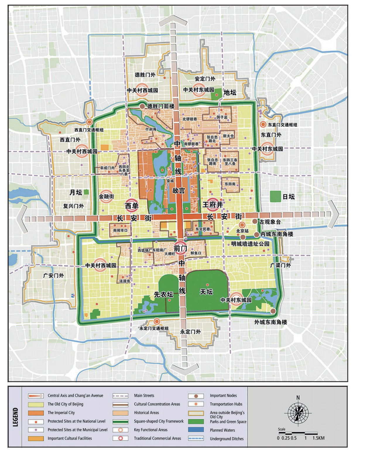
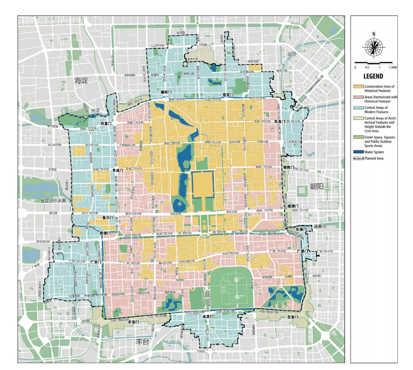
The Regulatory Plan for the Core Area of the Capital (Block Level) (2018-2035) is also authorized by the Central Government, issued by the People’s Government of Beijing Municipality, and enjoys a high level of authority. The majority of The nominated property and buffer zone of Beijing Central Axis falls in the core area of the capital. The Regulatory Plan for the Core Area of the Capital (Block Level) (2018-2035) raises comprehensive requirements for the conservation, management,and control of the historical environment of The nominated property and buffer zone of Beijing Central Axis.
The plan adopts the same positioning of the function and role of Beijing Central Axis as the Beijing Master Plan (2016-2035) and proposes that the Axis’ leading position for the spatial order of the core area shall be strengthened. The plan requires that the spatial layout of the old city of Beijing shall be enhanced and points out that multiple measures, such as “integrating the protection of city site remains, the restoration of historic water systems, and the construction of green spaces,” to “present the complete and distinct contour of the quadruple-layered framework of the walled-city, and enhance the checkerboard road network layout of the old city.” The plan also specifies 1l types of objects in the core area that require prioritized protection, including diverse historical and cultural heritage resources of World Heritage sites, immovable cultural heritage properties, and listed buildings. All the conservation measures listed above have already been put in place.
The Conservation Plan the HIstorical and Cultural City of Beijing (2002) .
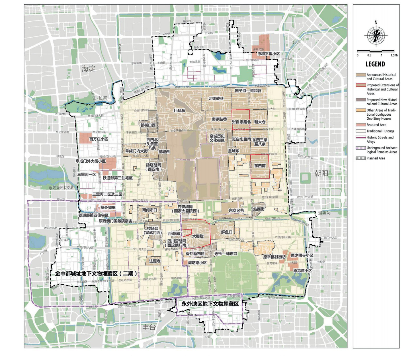
Beijing was on the first list of National Historical and Cultural Cities issued by the State Council in 1982. The Conservation Plan for the Historical and Cultural City of Beijing is a special conservation plan formulated at the beginning of the 21st century for the comprehensive conservation of the historical and cultural resources in the city to implement specific requirements for the historical and cultural city in the Beijing Master Plan.
The Plan sets out different conservation principles for key conservation areas and construction-control zones. Buildings within these areas are categorized into heritage buildings with official protective designations, buildings to be protected, buildings to be renovated, buildings to be retained, buildings to be remodeled, and street frontage buildings to be refurbished, with corresponding conservation and rehabiltation measures put in place.