The Ideal Location of a Capital City in the Traditional View

The geographical location of Beijing and the use of mountains and rivers in its urban planning conformed to the traditional Chinese concept of an ideal location of the capital city.

In the Warring States Period (475-221 BCE), the Guanzi, an ancient Chinese classic text, proposed that the location of the capital city should be adapted to geographical conditions, making clever use of the natural environment:“Whenever a city or town is built, it must be built near a river or at the foot of a mountain. The terrain must not be so high as to be close to dry areas so as to ensure a good supply of water or so low as to be close to waterlogged areas so as to save the effort of building embankments and channels. You must rely on natural resources and take advantage of the terrain....

This gist is that a capital city must be built not only at the foot of a mountain but also near a big river. The terrain must not exceed arid land to ensure sufficient water supply. Nor must it be lower than where water is easily accumulated to save the labor in building dams and channels. Both natural resources and advantageous geological conditions must be considered.

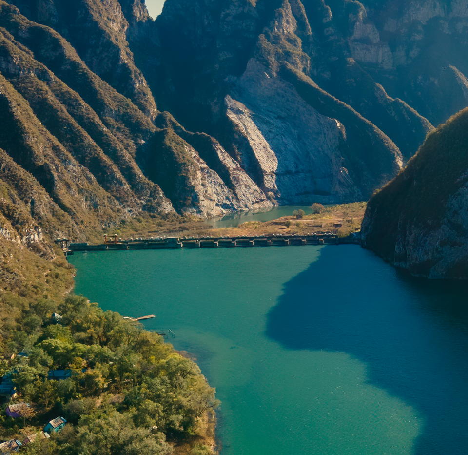
Yongding River

Yanshan Mountains to the west of Beijing

“The Beijing Bay”: the Rational Use of Mountains and Rivers

The selection of the location of Beijing City was ingenious. Beijing was located between the nomadic region in the North and the agricultural area in the South, forming the shortest natural passage from the nomadic prairies to the farming plain. Therefore, it has been a vital geographical hub since ancient times.

Beijing is bordered by the Taihang Mountains to the west, the Yanshan Mountains to the north, and an alluvial plain sloping gently towards the Bohai Sea to the southeast. American geologist Bailey Willis describes this mountainous terrain as “Beijing Bay.” Located in the middle of almost parallel river basins: the Yongding River to the southwest and the Wenyu River and Tonghui River to the northeast, the city is blessed with a well-developed water system with most of the water bodies originating from the mountainous area in the northwest and meandering through the plain to drain into the Bohai Sea.

The selected location was extremely conducive to the settlement of a farming people. The mountains became a natural barrier to block the cold wind from the north. Abundant rivers not only ensure water supply for urban life and agricultural irrigation but also facilitate transportation by the Grand Canal, making Beijing the ideal location for a traditional capital city.

Mongolian Plateau

Yongding River

Taihang Mountains

Yanshan Mountains

Beijing

Wenyu River

North China Plain

A sketch map of the interface between the nomadic and farming civilizations in Beijing

Reference: A map drawn by Mr. Hou Renzhi in Beiping Lishi Dili (Historical Geography of Beiping)

The Use of the Mountain and Water System

Beijing Central Axis emphasized fully integrating natural landscape and environment in site selection and planning. The location selected for the Beijing Central Axis took the Yanshan Mountains in the northern part of the city as a natural backdrop, presenting a situation where it “faces the south while sitting in the north” and “closes in the north while opening in the south.” The arrangement was in line with the ancient Chinese concept of the south as the direction of light, and monarchs must manage the country while facing the south. The starting point of the central axis was chosen in part due to the waterbody at the Jishuitan Lake (now Shichahai Lake) during the Yuan Dynasty. It is tangent to the waterfront in the northeast to ensure ample water supply and create beautiful scenery. The Beijing Central Axis is against the mountains while nearing the water system, forming an urban landscape harmonious and unified with the natural environment.