Residential areas along Beijing Central Axis

Beijing Central Axis is not only the axis of the royal family but also the axis of the urban residents’ daily lives. From the Yuan dynasty to the present, Beijing Central Axis has connected multiple residential areas, bearing the rich and diverse residential culture of Beijing’s Old City. It serves as an important witness and carrier of traditional folk customs and the vibrant neighborhood culture of Beijing. The historically preserved symmetrical neighborhoods distributed on both sides of Beijing Central Axis include Shichahai Lake, Beiluoguxiang Alley, Nanluoguxiang Alley, Dashilan, Xianyukou, and Tianqiao-Zhushikou Historical and Cultural Area. These areas have been effectively protected.

The neighborhoods in the inner city: Shichahai Lake, Beluoguxiang Aley, and Nanluoguxiang Alley

Surrounding the Bell and Drum Towers at the northern end of Beijing Central Axis within the inner city are the historical and cultural neighborhoods of Shichahai Lake, Beiluoguxiang Alley, and Nanluoguxiang Alley. This area shows the distinctive urban pattern characteristics of the Yuan dynasty: the city blocks were planned around water bodies, presenting themselves as fishbone and checkerboard patterns. The area combined Beijing’s royal, gentry, and common people’s cultures, hosting rich folk activities.

Shichahai Lake

Among them, the Shichahai historic district evolved around a water system of a relatively free-spreading pattern of streets and alleys, with many alleys running on a slant on the lakeshore.

During the Yuan dynasty, the Jishuitan Lake was an essential pier and hub for transporting grain by canal to supply the capital. It promoted the prosperity of the Bell and Drum Towers neighborhoods, becoming home to many commercial zones and residential buildings. As the water surface narrowed and the pier disused, the surrounding areas around the waters gradually became scenic spots for residents, and the surrounding areas became home to many imperial mansions, government offices, temples, and residential houses.

The Complete Geographical Map of Beijing

The map drawn in the fourth year of the Tongzhi reign of the Qing dynasty clearly shows the contrast of the residential areas between the inner city (up) and the outer city (bottom).

South and North Luogu Alleys

The South and North Luogu Alleys on the east side of the cental axis are among the best-preserved neighborhoods from the Dadu of Yuan, retaining the neat “fishbone” hutong alley layout from the Yuan dynasty.

The neighborhoods in the outer city: Dashilan, Xianyukou, and Tianqiao-Zhushikou

The historical blocks distributed on both sides of the southern section of Beijing Central Axis in the outer city include the historical and cultural neighborhoods of Dashilan, Xianyukou, and Tianqiao-Zhushikou. The area took shape and developed during the Ming and Qing dynasties. Unlike the inner city, which continued the neat and uniform street pattern of the Yuan dynasty, the streets and alleys in the historical districts of the outer city are mostly winding and narrow, a result of random and naturally growing texture in history.

The Poetic Mood of Spring in the Capital scroll painting

Source: The Palace Museum in Beijing
The neat and regular streets and alleys and the enclosed Siheyuan courtyards sharply contrast the irregularly distributed streets and yards in the residential areas of the outer city.

Dashilan

The Dashilan Historical and Cultural District is located on the west side of Qianmen Street. As a passageway once connecting the Dadu of Yuan and the Zhongdu (Central Capital) of the Jurgen Jin Dynasty, some of the areas had streets on the slant. In the Ming Dynasty, residents were registered and managed with streets and alleys as the basic management units. Fences were set up at the entrances and exits of streets and alleys in the area, opened and closed at regular intervals with the city gates for security and easy urban management. Hence it got its name Dashilan (Big Fences), which was an important residential and commercial space in the Ming and Qing dynasties.

Xianyukou

The Xianyukou Historical and Cultural District is located east of Qianmen Street. Under the influence of the Sanli River system, the area’s layout has become such that its streets and alleys crisscross randomly. It gradually became a dense residential area for civilians with the construction of the outer city and the prosperity of Qianmen Street in the Ming and Qing dynasties.

Historical photos of acrobatic performances at Tianqiao in Beijing’s Old City
The residential areas in Nancheng (South City) were not only characteristics of natural growth in the urban planning pattern but also more down-to-earth where cultural features were concerned.

Tianqiao-Zhushikou

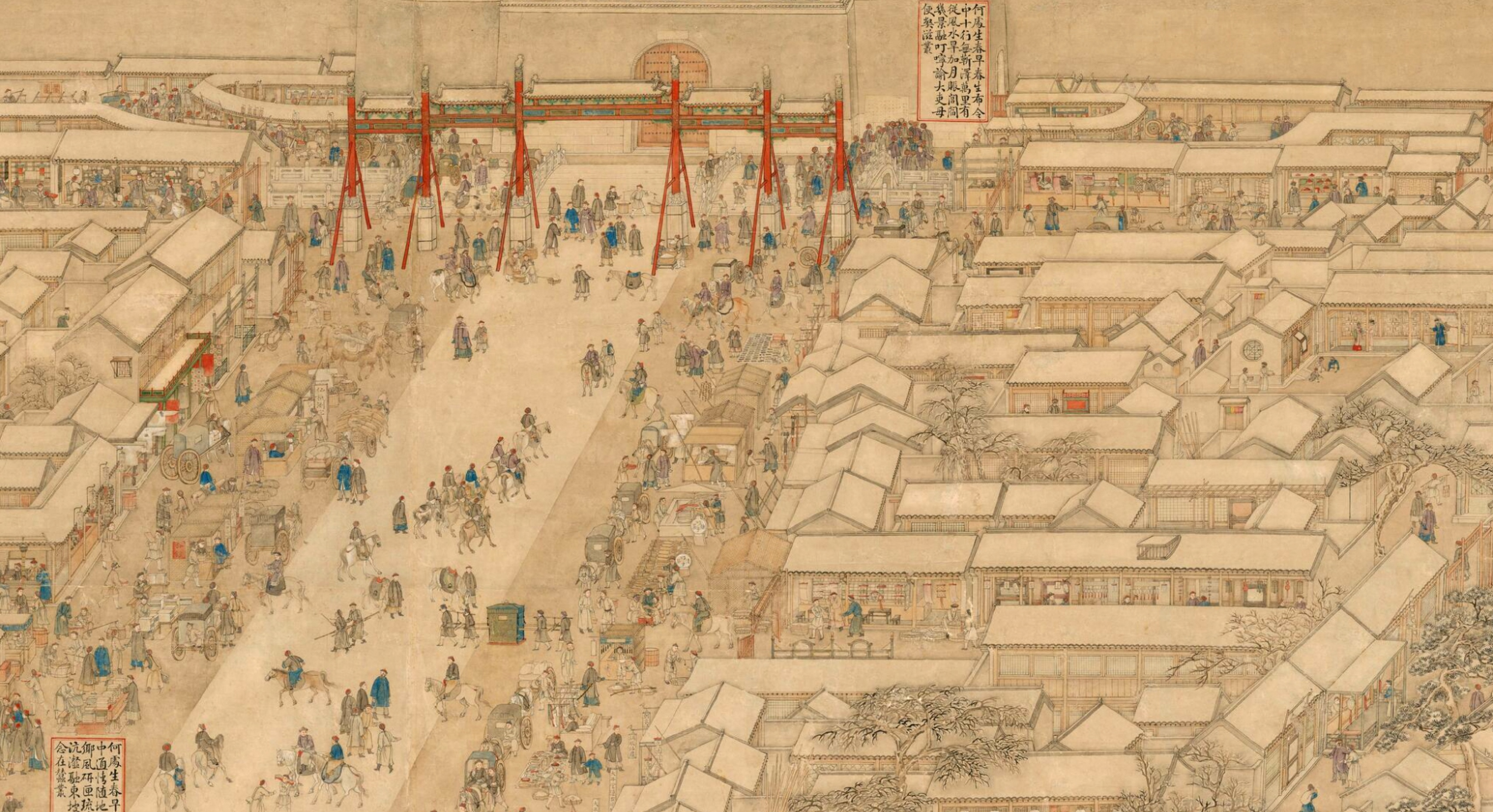
Zhushikou (literally “Entrance of the Pearl Market”) was called “Entrance of the Hog Market,” with “pearl” and “hog” homophonic in Chinese. Therefore, the area had initially been a market for selling pork.

Tianqiao (literally “Celestial Bridge”) originated from a stone bridge built to facilitate the emperors’ passage to the Temple of Heaven and the Altar of the God of Agriculture to offer sacrifices during the Ming and Qing dynasties. Since a Chinese monarch called himself the “Son of Heaven” and the purpose of the emperors’ sacrificial rituals was to communicate with heaven, the bridge got its name, the “Bridge of the Son of Heaven” or simply “Bridge of Heaven,” pronounced as Tianqiao.

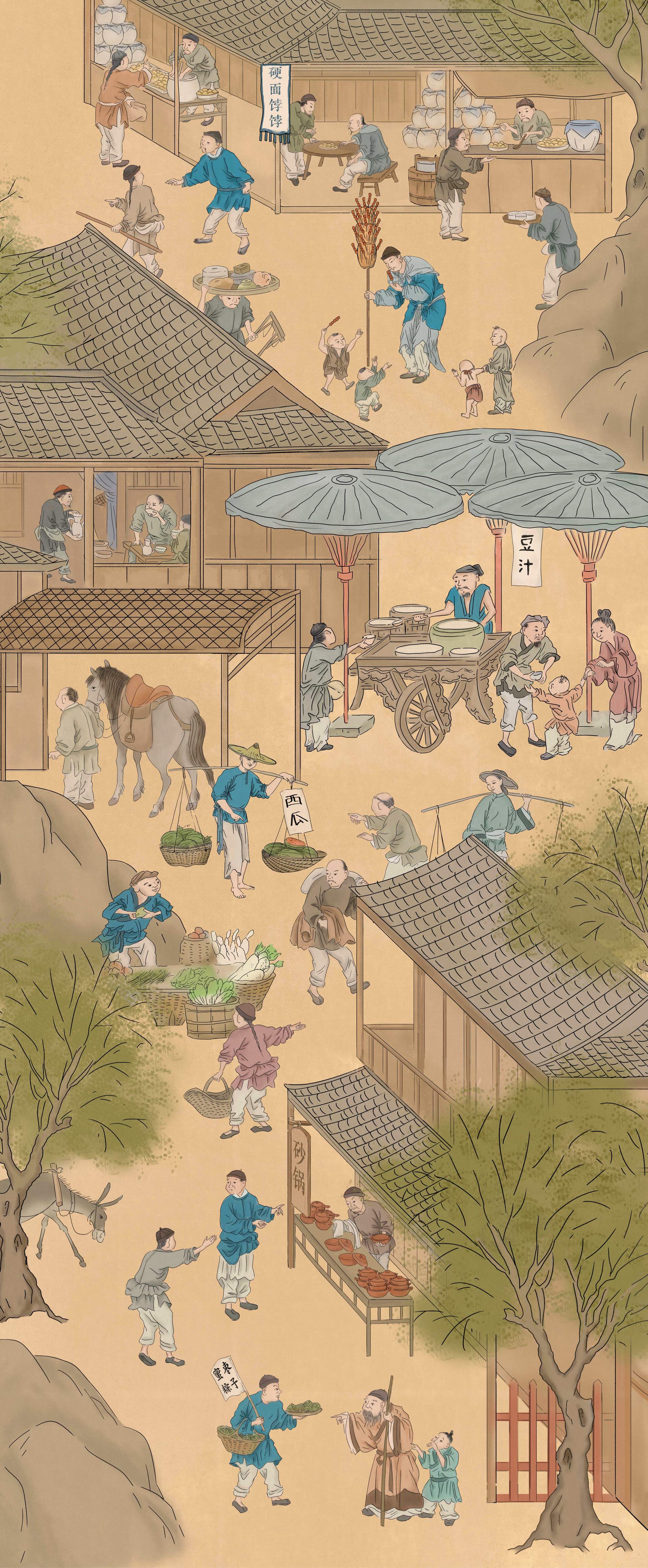
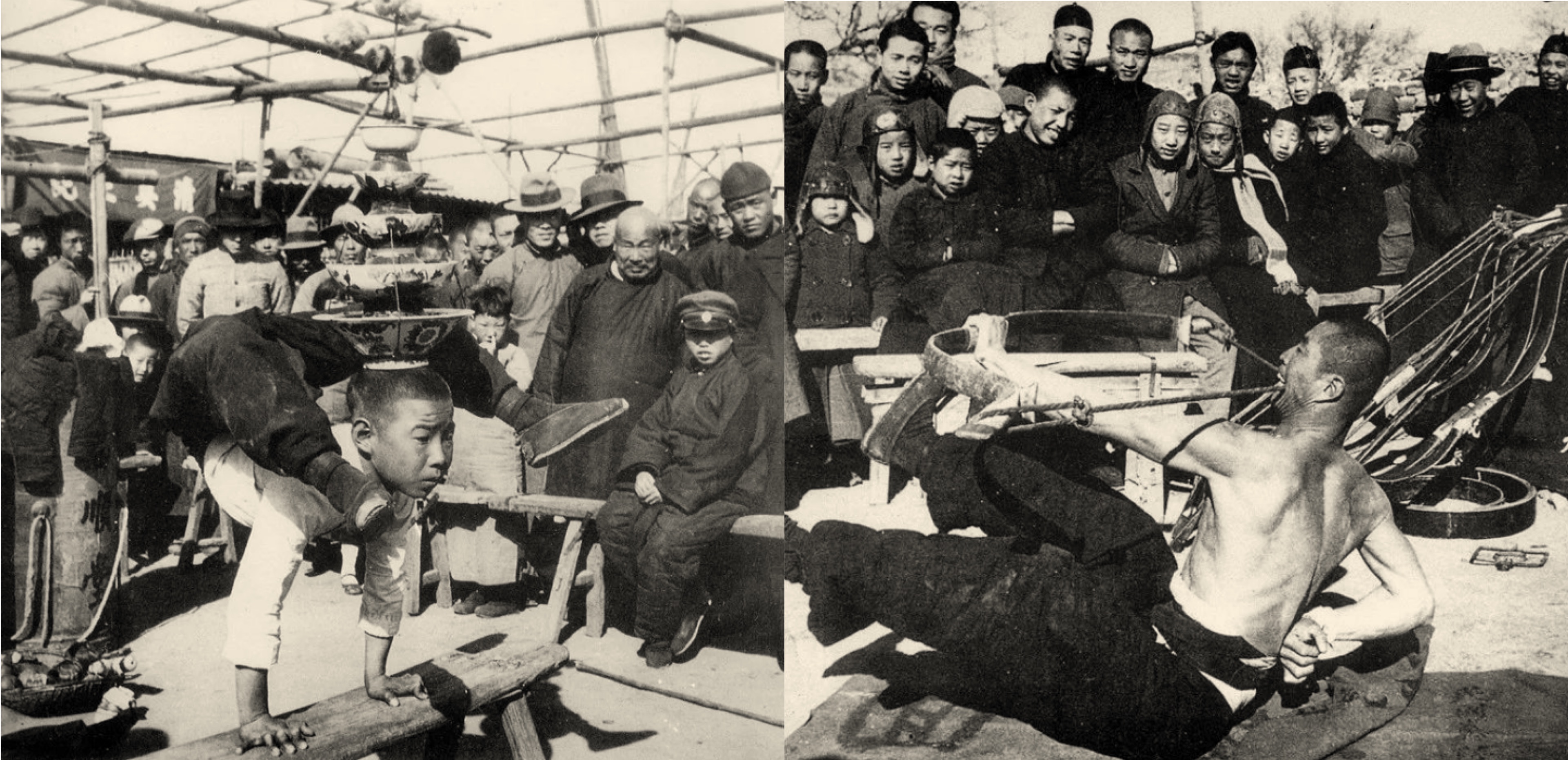
Today, it was transformed into an underground stream. The area around Tianqiao became home to popular civilian entertainment and commercial markets. Today, the Tianqiao area is still a venue for various cultural activities.

The residential blocks in the outer city brought about the rich axial landscape and unique urban functions south of Beijing Central Axis. They showed the characteristics of commerce and urban cultures completely different from those of the inner city.

Home